Features Moonscape3D
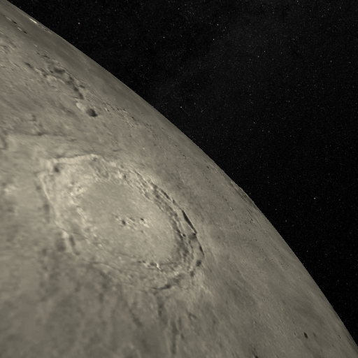
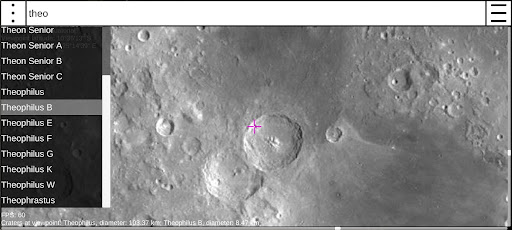
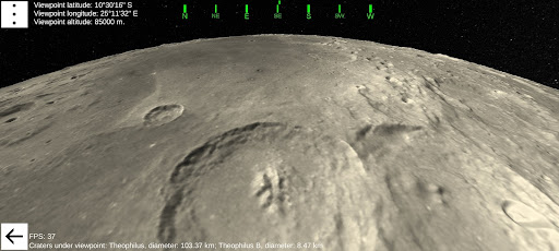
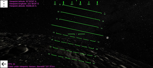
This application allows the users to generate the textured models of 3D moonscape up to 40° x 40° (~1200 x 1200 km.) around any point of the moon surface with resolution down to 400 meters per pixel.It uses digital elevation data in polar stereographic projection for the north (above the latitude 45°N) and south (below the latitude 45°S) polar regions, and cylindrical projection for the equatorial region (between the latitudes 45°N and 45°S).This data is obtained by the Lunar Orbiter Laser Altimeter, an instrument onboard the NASA Lunar Reconnaissance Orbiter mission -Lunar Reconnaissance Orbiter LOLA Science Team Global Data Record (2019), Planetary Data System Geosciences Node: https://doi.org/10.17189/1520642This application can also simulate the illumination of the generated moonscape with various suns height above the moon horizon.It contains database with more than 7000 most prominent moon craters, to search and observe the features of the specific one.Use the standard Android gestures - sweep, rotate, zoom-in and -out - to move the viewpoint over the generated moonscape and explore the surface of our nearest celestial neighbour.
Food & Dining
Discover recipes and order food from your favorite restaurants.
See the Moonscape3D in Action
Get the App Today
Available for Android 8.0 and above